Scope
This document presents the
results of measurements taken at the Cape Town International Airport on
Friday 3 October 1998.
Introduction
Water has been found under the surface of the runway at Cape Town International Airport. Various core samples have shown that different areas have different water saturation levels. Due to the size of the runway and the destructive nature of taking core samples - this method of providing the required understanding of the water problem is not feasible.
Ground Penetrating Radar provides a possible alternative. It is for this reason that the measurements presented in this report were requested.
The report presents the processed images of the radar data collected a various points along the runway. The first three sets of results - present the radar data as 2D images scaled using different maximum and minimum end points.
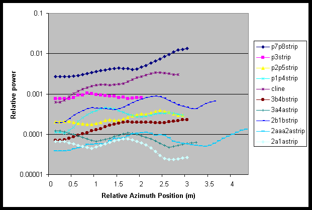
The final graph presents
a measure of the energy reflected from the subsurface targets.
Radar Equipment
The radar equipment used
was a 1-2GHz stepped frequency continuous wave radar. It was configured
to take 100 frequency steps over the radar bandwidth. If we assume that
the mean permittivity of the subsurface medium is 9, then the radar resolution
in the ground is approximately 5cm.
Process Radar Images
The raw radar data was processed
using standard Discrete Fourier Processing techniques. The data was interpolated
to provide better images. Three sets of results are presented. Each set
consists of an image of the processed data from each of the measurement
sites. The data in each set various only in the scaling end points used.
In each plot, the horisontal axis is in metres, and the vertical axis in
metres, assuming a permittivity of 9.
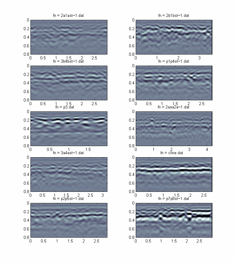
Figure 1: Each image scaled to the maximum and minimum value of all profiles
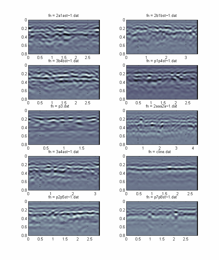
Figure 2: Each image scaled to its
own maximum and minimum value
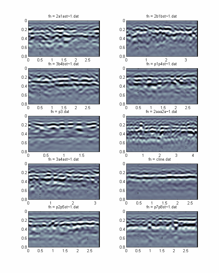
Figure 3. Each image scaled to its
own average maximum and minimum values.