MercuryB Radar Results Page
The radar parameters for all the radar
measurements are listed below:
| Fo |
200MHz |
| dF |
10MHz |
| N |
80 |
| Er |
6 |
Please excuse the fact that the radar data does not include an Z and
X scale. For images the dimension down the page is the depth into the ground
and the dimension across the page is the along track (X) dimension.
8 July 1999 - We have made some software and minor
hardware improvements
Another cross section of the 6th floor passage outside the Radar Lab.
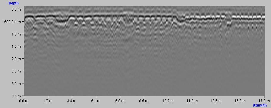
Looking for powerlines outside an electrical sub-station (Cape Town)
Cross-section of a road ( off the mainroad in Tokai (Cape Town))
Moving from a road to a concrete driveway (original Blouberg test site)
In the backyard of a house in Blouberg Cape Town
15 June 1999
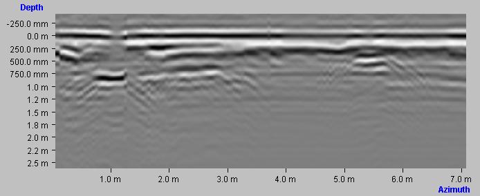
Cross section of the 6th floor passage outside the Radar Lab.
NOTE: The small hyperbolic profiles are the radar returns from concrete
re-inforcing bars
SCAN Distance: +/- 20m spacing 0.1 m
OTHER: Approx maximum depth is arou d 1.2m (of the image)
.jpg)
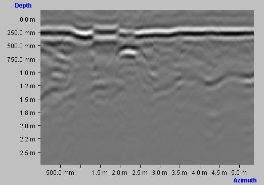
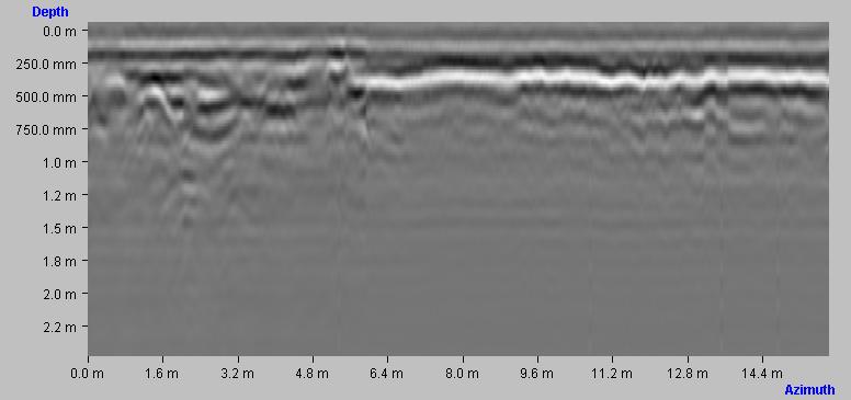
Cross section over road bed on the ground floor outside the Menzies building
NOTE: The hyperbolic profiles from the pipes are easily visible
on the right of the image. These
correspond with visual observations of the site.
SCAN Distance: +/-12m, sample spacing 0.1m
OTHER: Approx maximum depthof the image is around 2.2m
_1.jpg)
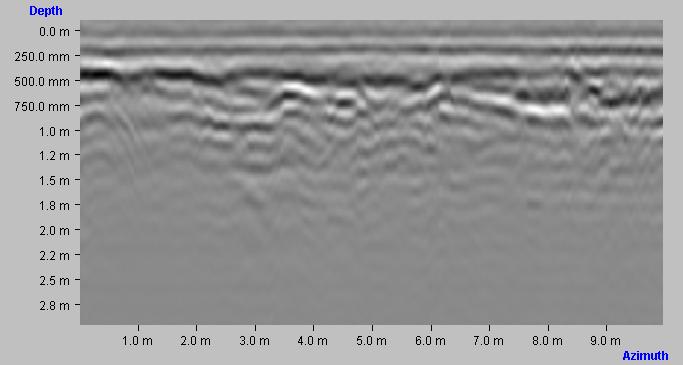
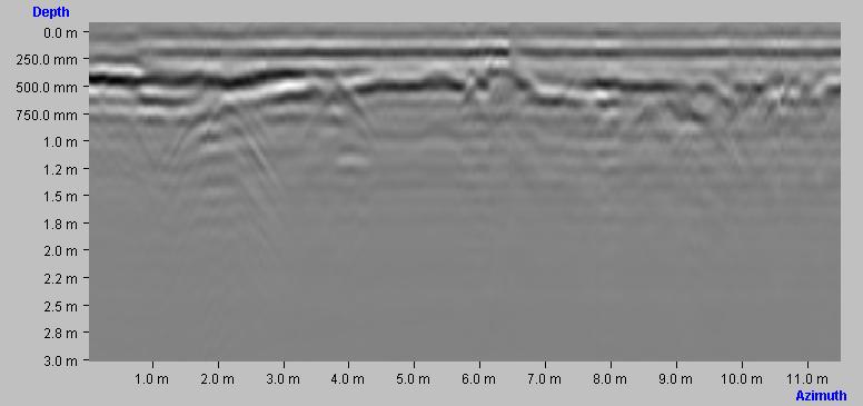
Cross section of a road bed over a sewage pipe at a depth of approx 1.2m
NOTE: The pipe return is again clearly visible. Note the
change of depth of a layer below the surface
SCAN Distance: +/- 8m, sample spacing 0.1m
OTHER: Approx maximum depth of the image is
around 2.2m
.jpg)
Return to MineRad
Home Page